
Wingtra LIDAR presentation
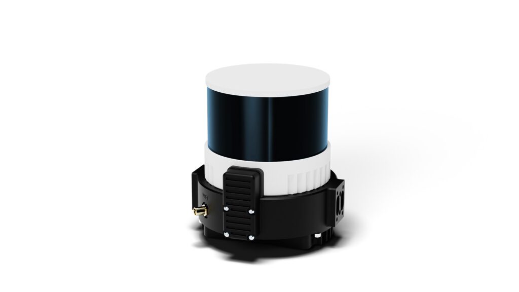
The LIDAR Wingtra is a major breakthrough in 3D modeling and topographic surveying. Designed by Wingtra, a leading Swiss company in the development of autonomous ADAV (vertical take-off and landing aircraft) drone solutions. This system offers state-of-the-art features for collecting high-precision geospatial data.
With its new Lidar, Wingtra sets new standards for the industry, with the following specifications:
| Effective point density in the deliverable at 90 m AGL with 50% lateral overlap | – Hard surface: ~110 pts/m² (single return); – Low vegetation: up to 220 pts/m² (double return); – High vegetation: up to 330 pts/m² (triple return). |
| Effective point density in the deliverable at 120 m AGL with 50% lateral overlap | – Hard surface: ~84 pts/m² (single return); – Low vegetation: up to 168 pts/m² (double return); – High vegetation: up to 252 pts/m² (triple return). |
WingtraOne GEN II (VTOL), the perfect combination with LIDAR
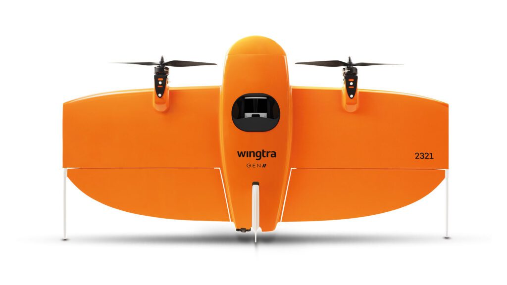
The LIDAR Wingtra is specially optimized to work perfectly with the WingtraOne GEN II WingtraOne GEN II drone . This combination offers exceptional stability and precision, even in harsh environments. With its ability to reach high flight altitudes while maintaining remarkable accuracy, the WingtraOne GEN II is the ideal tool for taking full advantage of LIDAR’s capabilities on large-scale projects.
The synergy between LIDAR and Wingtra Hub Pro
The license Wingtra Hub Pro is included with the Wingtra LIDAR sensor. It offers a robust, user-friendly data processing platform, enabling users to visualize, analyze and extract valuable information from the data collected by the Wingtra LIDAR.
Thanks to advanced features such as generation of dense point clouds and thehe creation of detailed digital terrain modelsWingtra Hub Pro optimizes the efficiency of the data handling process, enabling professionals to make the most of their data. 3D modeling and precise topographical surveys precision and efficiency.
Wingtra has made available sample data that you can explore and download to get a glimpse of Wingtra’s efficient and accurate LIDAR mapping capabilities.
| LIDAR forest mapping Sensor: Wingtra LIDAR Coverage: 300 ha (741 acres) Data: here | LIDAR construction site Sensor: Wingtra LIDAR Coverage: 30 ha (74 acres) Data: here |
However, you can continue to work with your current processing software, as long as it is compatible with the Pix4D Matic solution.
Price and accessibility of the Wingtra LIDAR system
Finally, the Wingtra Lidar offers an exceptional combination of performance and accessibility. Compared with other solutions on the market, the Wingtra system offers real productivity gains for all large-scale projects. Its excellent value for money makes it attractive for a wide range of applications. Consult our store for the exact price of the new Wingtra LIDAR sensor.