
The DJI Zenmuse P1 integrates a full-frame sensor with an interchangeable fixed-focus lens on a stabilized 3-axis gimbal (24, 35 and 50 mm Lister). Designed for photogrammetry missions, it pushes the limits of efficiency and precision bringing an obvious time saving since we can carry out higher surveys to cover the same area, therefore in less flight time.
Description of performance (DJI)
The P1 features a low-noise, high-sensitivity full-frame (No optical zoom) sensor capable of taking a photo every 0.7s and covering 3 km2 in a single flight.
- Efficiency adapted to all needs in photogrammetry, modelling, volumetry, topography ;
- 45 MP full-frame sensor ;
- The TimeSync 2.0 function synchronizes the camera, flight controller, RTK module and gimbal down to the microsecond.
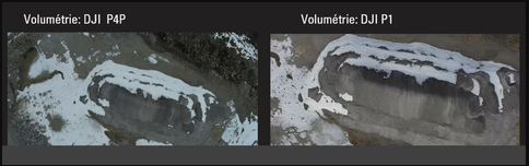
Comparison DJI P4P VS DJI Zenmuse P1
Detailed performance analysis by our team
| Characteristics | P4P | P1 |
| Pixel name (Mpx) | 20 | 45 |
| Operation temperature | 0 to 40 ° C | Down to -20°C |
| Focal distance | 8,6 mm | 35 mm |
| GSD 60 meters | 1,63 cm | 0,73 cm |
| GSD 120 meters | 3,26 cm | 1,46 cm |
Capacity
With an excellent scanning capacity, it makes it possible, for example, to survey more than 50 Ha per 43-minute flight when the camera is equipped with a 24 mm lens at a flight height of 55 meters (GSD = 1 cm).
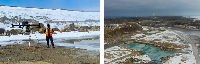
In quarries or mines, during automated flights, it is not necessary to modify your flight height (High or low levels), you will obtain efficient ground data (Pixels) in the deeper places of the site.
“The definition of the images is incredible and incomparable, which makes the pair Matrice 300 and Zenmuse P1 an excellent choice for photogrammetry projects. »
Maximilien Menard – Advisor in strategic support
Image processing
Quality and image processing in PiX4D: at 60 m we have 200-400 points/m2 for the P4, 7000 points/m2 for the DJI Zenmuse P1. The results being compatible with several photogrammetry software, the processing time and the quality of the results will also depend on the area covered and the flight parameters.
Applications according to our team
These different flight modes will make it possible to operate in many areas :
- Topography ;
- Architecture ;
- Archeology ;
- Land work (Ex.: search for plot boundaries) ;
- Construction and civil engineering ;
- Environment ;
- Insurance expertise (Ex.: observation of natural damage, observation after accident) ;
- Emergency reconstruction for police or fire departments.
The opinion of DroneXperts
Saving time in the field, improving quality appreciated by our teams. Possibility of working at a good height with increased image quality.
You can practically double the flight height while having optimized quality and performance. So in less time and with the same quality we will be able to cover larger photogrammetry surveys (depending on the focal length). The Zenmuse P1 is undoubtedly a product that would optimize the return on investment during photogrammetric surveys.